Description
Algeria climate map. Digital Maps Online. Adobe Illustrator .AI EPS Vector files from our Netmaps database. Digital Maps Online. Adobe Illustrator .AI EPS Vector files from our Netmaps database.

65.00 €
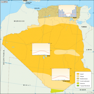
Algeria climate map. Algeria Map. Carte Algerie (Fr). Mapa Argelia (Esp).
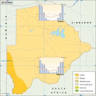
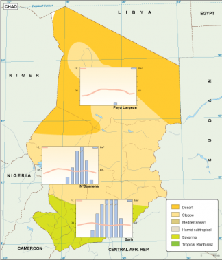
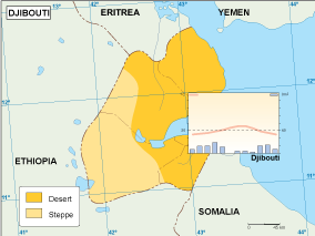
Eps Adobe Illustrator weather map. Our Climate map uses climate legends to show the parts of the country that has a specific climate.
A climograph form several cities of the country that shows the annual (monthly) cycle of temperature and precipitation for a geographical location. All information is vector data.
All maps and climographs can be enlarged in proportion to any size as the file supplied is in vector format. You can change artwork in any way. All colors, lines, and text fully editable.
Algeria climate map. Digital Maps Online. Adobe Illustrator .AI EPS Vector files from our Netmaps database. Digital Maps Online. Adobe Illustrator .AI EPS Vector files from our Netmaps database.