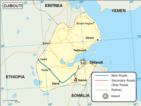
Djibouti transportation map

55.00 

Djibouti transportation map. Eps Adobe Illustrator map. Our Transportation vector map from our series of Africa Maps. With Rivers, selected cities, highways, railroads, main airports and ports.

All maps can be enlarged in proportion to any size as the file supplied is in vector format. You can change artwork in any way. All colors, lines, and text fully editable.

Description

Djibouti transportation map. Digital Maps Online. Adobe Illustrator .AI EPS Vector files from our Netmaps database. Djibouti Vector maps from Africa. Illustrator EPS files, fully editable from our African map database. All our digital cartography was created with Vector Adobe Illustrator