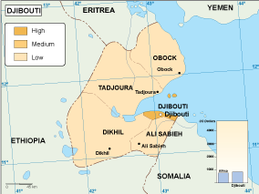
Description
Djibouti economic map. Economic map. Our vector eps illustrator map. Our vector map has the three basic symbol types for vector data as points, lines and polygons (areas).
Our team of cartographers use these symbols to represent real-world features in maps, they often have to decide based on the level of detail in the map. In a economic map our map illustrates various economic phenomena and activities in a countryDigital Maps Online. Adobe Illustrator .AI EPS Vector files from our Netmaps database. Djibouti Vector maps from Africa. Illustrator EPS files, fully editable from our African map database. All our digital cartography was created with Vector Adobe Illustrator