Skip to navigation Skip to content
Netmaps. Leading Mapping Company

Vector eps City maps and Wall Maps. ©Netmaps from 1997

  • Home
  • Vector Maps
    • Africa Vector Maps
    • America Vector Maps
    • Asia Vector Maps
    • Europe Vector Maps
    • Oceania Vector Maps
    • Vector Cities
    • Vector And Wall Maps by Netmaps
  • Ppt Maps
  • Wall Maps
    • World Wall Maps
    • Continent Wall Maps
    • Country Wall Maps
    • City Wall Maps
  • Projects
  • Clients
  • Contact
  • 0.00 € 0 items
Home / Africa / Africa country maps / gambia blind map / gambia blind map

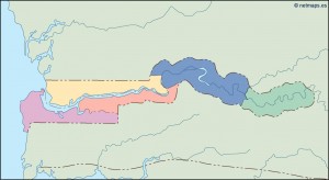
gambia blind map

gambia blind map

gambia blind map

Post navigation

Previous post: gambia blind map
Maps Directory
  • Africa (703)
  • America (601)
  • America North Maps (128)
  • America Central Maps (165)
  • America South Maps (159)
  • Asia (420)
  • Europe (1325)
  • Oceania (118)
  • City Vector Maps (597)
  • Wall Maps (476)
  • Vinyl Sticker Maps (240)
  • Framed Maps (74)
  • Magnetic Maps (491)
  • Powerpoint maps (205)
Cart
Download maps

Once a map is paid we will send you our vector map:

-- via direct email and
-- a copy via Wetransfer

Delivery is usual in minutes from your order, but it can takes some hours in weekend.

Vector maps
https://youtu.be/hMXKi01vRQw
About vector maps
  • What’s a vector map?
  • Illustrator for maps
  • Maps are royalty free
  • How to buy maps online
Vector Map Files

From simplest maps to
the most detailed vector maps
——————————–
Illustrator, Freehand & Eps Files
Editable – Layer Structured
Worldwide delivery via email
Copyright Netmaps®, 1997-19

Maps Cloud
Afrika Karte blind country map blind eps maps blind maps blind maps of the world blind political map blind vector maps Cartes Afrique vector city eps maps city map Europe city maps of download city maps of Europe eps countries of the world country maps of the world country vector maps Country Vector Maps Africa. Vector Africa Maps. Illustrator maps of Africa. eps maps of african countries. Download maps of Africa. Africa country maps. Cartes Afrique Country Vector Maps Asia. Vector Asia Maps. Illustrator maps of Asia. eps maps of asian countries. Download maps of asia. Asia country maps Country Vector Maps Europe. Vector Europe Maps. Illustrator maps of Europe. eps maps of european countries. Download maps of Europe. Europe country maps eps city maps Europe eps maps Europe city Europe city maps Europe City vector maps. eps city maps of Europe. Street maps of European cities. City maps Europe Eps files Europe illustrator city maps illustrator eps maps illustrator maps illustrator maps of the countries of the world mapas Africa mapas ciudades España map city Europe eps maps of countries maps of the world maps political blind physical eps maps physical maps of countries physical vector maps political division of country map political maps provincial maps regional maps regions of countries topographical maps topographical maps of countries vector maps world maps blind
Vector Maps ready!

Illustrator & Eps Formats
Fully Editable files
Royalty free rights
Largest worldwide database
Delivery 24 X 7. Automatically via email

Vector original files!
Maps' database has been created with digital formats, mainly Macromedia Freehand (eps) and Adobe Illustrator (ai), which makes it easy to adapt to the new standards.

Our maps can be delivered in any version of Adobe Illustrator (from 5.5 to latest versions CS), EPS, PDF or Macromedia (from 8.0 to MX). All our maps can be modified easily with your vector software.

Royalty Free Maps

All of our maps are royalty free. This means that there is a one off cost for the digital file without having to pay any extra costs for reproduction, reprinting or any other product usage. So you can reproduce the maps as many times as you like!

You DO NOT need to:
— pay for each use
— pay per volume sold
— pay for period of use

Always order in our original websites.
Do not be confused!

And our best references:
– Copyright Netmaps®
– Clients in 119 countries

Wall Maps

Size 92 cm. Smaller side
Printed in special paper

Always Laminated Wall Maps
Write on Wipe off Wall Maps
U can write and erase over maps
Encapsulated Wall Maps.
U can stick easily on any wall
Double sided laminated

Free Delivery Worlwide
Price always – 79.50 € – for any place in the world

All Wall Maps are delivered in our special tubes

Contact

Central Office:

NETMAPS®
Corts Catalanes 5-7
Edif. Trade Center
08173 Barcelona

Fax. 00 34 504 10 51

Helping you online 24 X 7:
Email: [email protected]


Payments online:
Our website uses cutting-edge data encryption, fraud detection tools and all kinds of other advanced techniques to improve security. This is why you will feel comfortable paying us online.

Major credit cards accepted via our website

© Netmaps. Leading Mapping Company 2023
Built with Storefront & WooCommerce.
  • My Account
  • Search
  • Cart 0