Russia Land Use map
Russia Land Use map
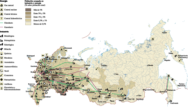
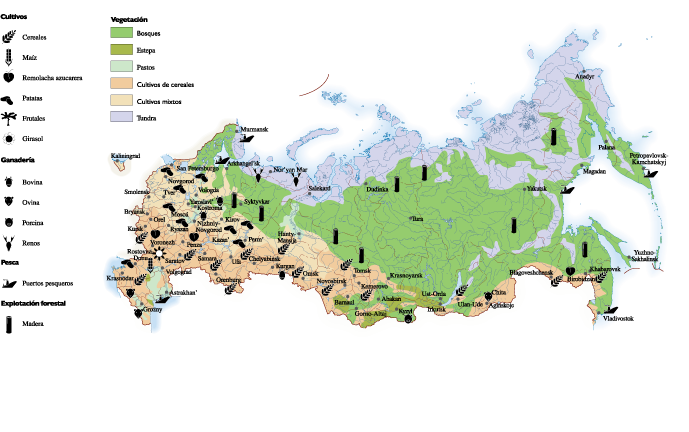
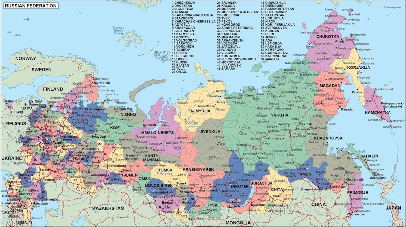
Russia Economic map. Economic map. Our vector eps illustrator map. Our vector map has the three basic symbol types for vector data as points, lines and polygons (areas).
Our team of cartographers use these symbols to represent real-world features in maps, they often have to decide based on the level of detail in the map. In a economic map our map illustrates various economic phenomena and activities in a country
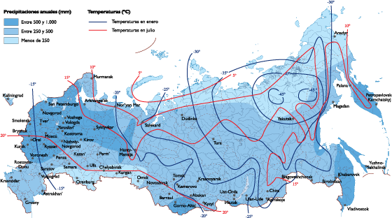
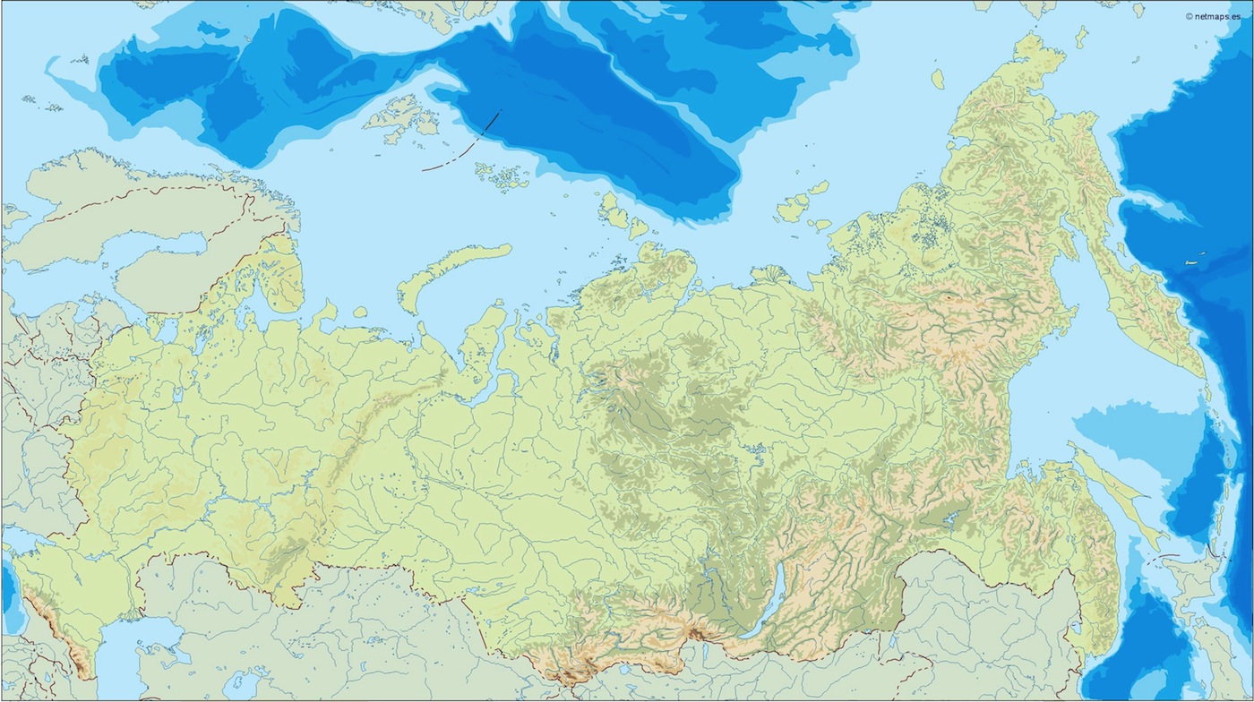
Russia Climate map
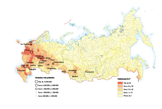
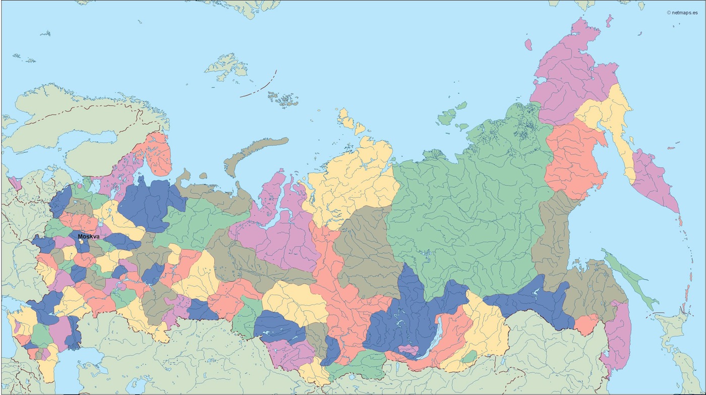
Russia Population map

russia vinyl sticker maps

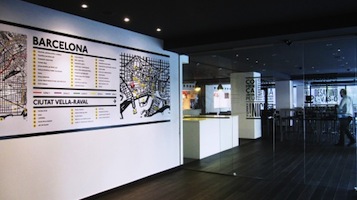
russia framed maps

magnetic map russia. Magnetic Wall Maps from Netmaps are useful planning and tracking tools. Use magnetic markers and symbols to track customers, delivery points, service centers and much more.
Our magnetic maps are also laminated write on / wipe off and framed. We also sell colored magnets that you can have color coded to match your map needs.
All our Wall Maps are available as Magnetic Wall Maps. Worldwide delivery.
russia presentation map. Our map is part of our Netmaps’ Collection of PowerPoint Maps and Map outlines that you can use in your presentations.
Download editable maps for PowerPoint presentations with customizable maps that helps you prepare awesome presentations with sales by country or territory. Our editable PowerPoint maps are perfect for sales, marketing and supply chain presentations. We have country maps, continent maps and also World maps.
All PowerPoint slides are available in Microsoft’s .ppt format. This means that you should use MIcrosoft PowerPoint or OpenOffice. You can change the colours and lines to create interesting effects and designs. All slides come with a standardized colour scheme, effect and background design. If you wish to use your company’s corporate design, simply copy the slides into an existing company presentation and apply the design to the slide. That way slides could adopt your corporate design.
Creating thematic maps for Business or Marketing such as territory maps or sales maps is simply because all countries and maps are individual selectable shapes. Netmaps gives you the opportunity to create effortless dynamic custom maps for your presentations. They are professionally designed, perfectly optimized for business presentation requirements and ready to customize.
wall map russia. Size: 92 cm (smaller side). Laminated write on / wipe off. All maps are writable with Velleda Markers and encapsulated. Worldwide delivery for free. Included in price
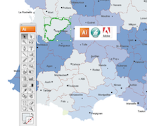
russia illustrator map. Digital Maps Online. Adobe Illustrator .AI EPS Vector files from our Netmaps database. Vector maps from Europe. Illustrator EPS files, fully editable from our european Country map database. All our digital cartography was created with Vector Adobe Illustrator
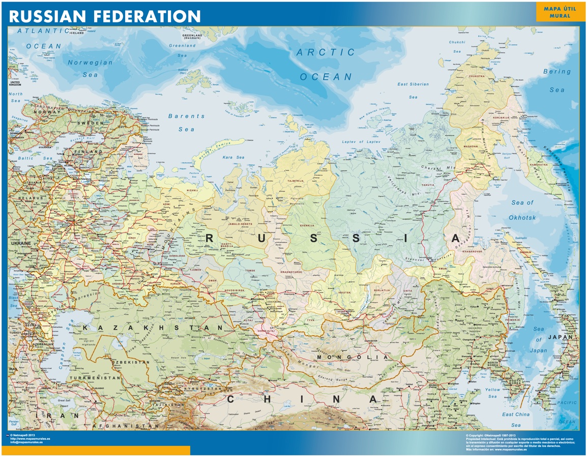
russia political map. Digital Maps Online. Adobe Illustrator .AI EPS Vector files from our Netmaps database. Vector maps from Europe. Illustrator EPS files, fully editable from our european Country map database. All our digital cartography was created with Vector Adobe Illustrator

russia blind map. Digital Maps Online. Adobe Illustrator .AI EPS Vector files from our Netmaps database. Vector maps from Europe. Illustrator EPS files, fully editable from our european Country map database. All our digital cartography was created with Vector Adobe Illustrator
russia vector map. Digital Maps Online. Adobe Illustrator .AI EPS Vector files from our Netmaps database. Vector maps from Europe. Illustrator EPS files, fully editable from our european Country map database. All our digital cartography was created with Vector Adobe Illustrator
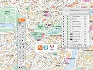
| Maps Store: Vector EPS Maps All countries of the world as vector EPS Illustrator files
All our maps has been created via Adobe Illustrator or Macromedia freehand. Maps are templates ready to be edited with your design software. | City Illustrator Maps Digital Vector City maps for your projects
Download our vector files for any of our city maps, from streetmaps detailed to area maps. More than 10 000 cities availables of the world |
| Powerpoint Maps for Presentations You need to improve any presentation with maps. Take our editable maps for Powerpoint or Open Office
| Maps for your company Bespoke maps. Promotional Projects, Atlases. Any project where you need a map just let us know. From country maps to ZIP postal codes maps from any country of the world.
|
Laminated Wall Maps, 79,50 euros. Maps are Write on / Wipe off. Velleda ©Bic. Worldwide delivery included | Magnetic Framed Maps, 449,50 euros. Maps on a metallic board, ready for magnets. Worldwide delivery included  |
Country Wall Maps: Our wall maps are always writable laminated (Velleda). They are sent in special tubes and world wide delivery is included for free in our price, 79,50 €
Europe is one of the five continents. More than 3000 vector maps (illustrator eps files) of Europe, countries, thematics or cities, are online to be downloaded.
available in Adobe Illustrator, EPS, PDF, PNG and JPG formats to download. Our collection is designed to easily create your own map projects for personal or commercial use without any restriction, for graphic designers, journalists, students and people who need to create maps easily and quickly.
Bosnia-Herzegovina Maps
Bulgaria Maps
City of Vatican Maps
Croatia Maps
Czech Republic Maps
Denmark Maps
Estonia Maps
Finland Maps
France Maps
Germany Maps
Greece Maps
Hungary Maps
Iceland Maps
Ireland Maps
Italy Maps
Latvia Maps
Liechtenstein Maps
Lithuania Maps
Luxembourg Maps
Macedonia Maps
Malta Maps
Moldova Maps
Monaco Maps
Montenegro Maps
Norway Maps
Netherlands Maps
Poland Maps
Portugal Maps
Romania Maps
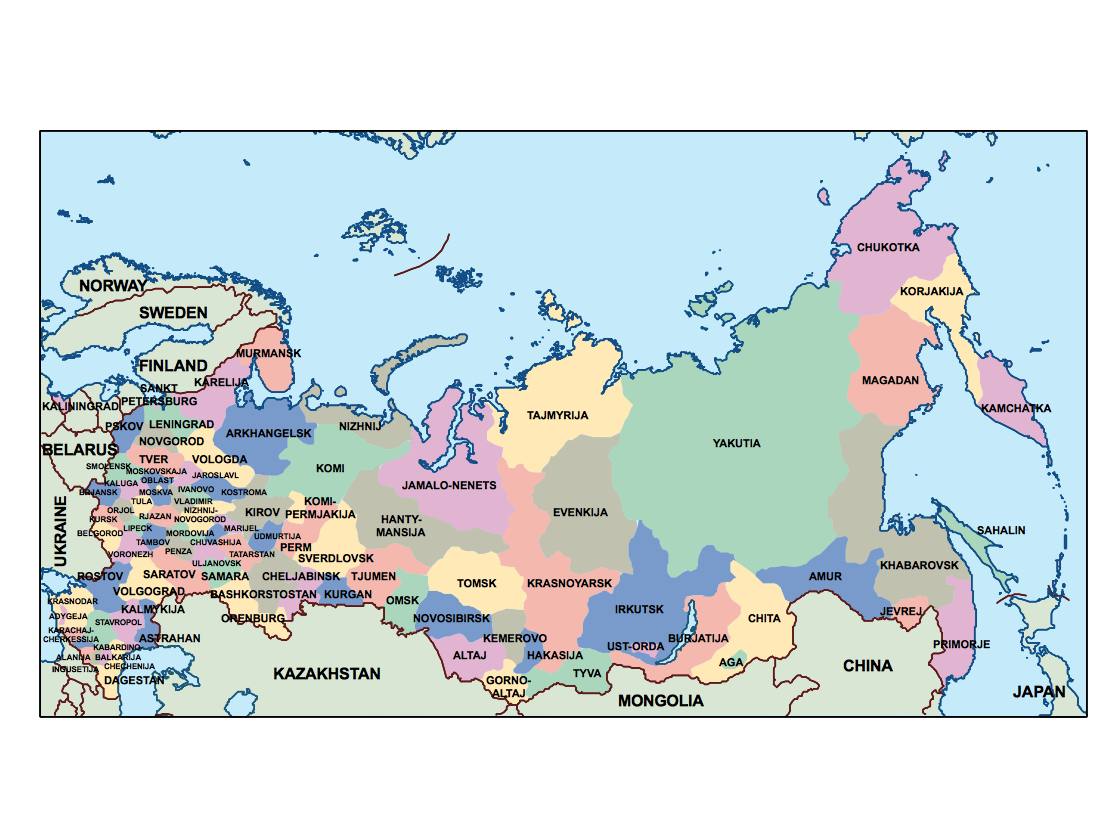
Russia Maps
San Marino Maps
Serbia Maps
Slovak Republic Maps
Slovenia Maps
Spain Maps
Sweden Maps
Switzerland Maps
Turkey Maps
Ukraine Maps
United Kingdom Maps