Algeria Maps
Algeria is a country in the Western part of North Africa. The capital city is Algiers. It is the largest country in Africa. Our files are illustrator eps, fully editable
Algeria vector maps
Our files are illustrator eps, fully editable. There are also some options of wall maps. Explore the diverse landscapes and vibrant cities of Algeria with our collection of vector EPS maps. These high-quality maps are perfect for businesses, travelers, and researchers who need accurate and detailed information about Algeria’s geography and topography.
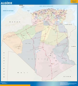
Our Algeria vector maps are available in a variety of formats, including Adobe Illustrator and EPS, making them easy to use and customize for your specific needs. With features such as highways, roads, rivers, lakes, and cities clearly marked, these maps provide an excellent resource for anyone looking to understand the layout and geography of Algeria.
Whether you are planning a business trip, conducting research, or simply exploring the country, our Algeria vector maps are the perfect tool for navigating this fascinating North African nation. With accurate and up-to-date information, you can feel confident that you are getting the most accurate and reliable data available.
Order your Algeria vector EPS map today and start exploring this beautiful and diverse country in greater detail!
Showing 1–16 of 17 results
-

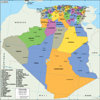
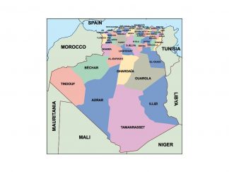
Algeria EPS map
80.00 € Add to cart -

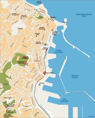
Alger vector map EPS
140.00 € Add to cart -

algeria vinyl sticker maps
89.00 € Add to cart -
algeria framed maps
449.00 € Add to cart -
magnetic map algeria
449.00 € Add to cart -

algeria presentation map
25.00 € Add to cart -
wall map algeria
79.50 € Add to cart -

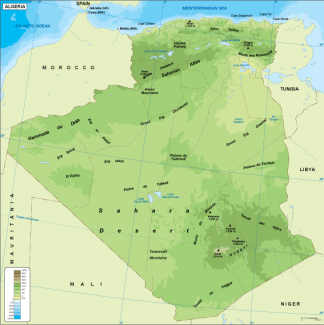
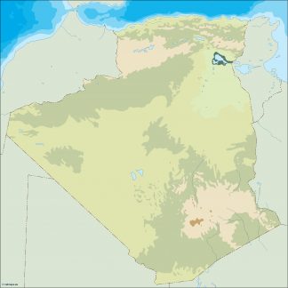
Algeria physical map
50.00 € Add to cart -
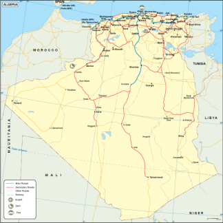
Algeria transportation map
55.00 € Add to cart -
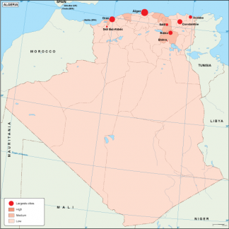
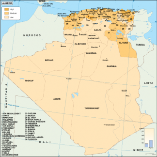
Algeria population map
60.00 € Add to cart -
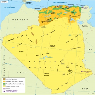
Algeria vegetation map
70.00 € Add to cart -
Algeria economic map
75.00 € Add to cart -
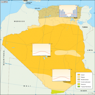
Algeria climate map
65.00 € Add to cart -
algeria illustrator map
29.00 € Add to cart -
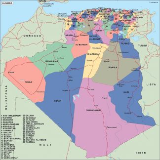
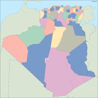
algeria political map
99.00 € Add to cart -
algeria blind map
35.00 € Add to cart


Showing 1–16 of 17 results